Patras (Dimos Patras)
Patras (Πάτρα ; Katharevousa and Πάτραι; Patrae) is Greece's third-largest city and the regional capital of Western Greece, in the northern Peloponnese, 215 km west of Athens. The city is built at the foot of Mount Panachaikon, overlooking the Gulf of Patras.
As of the 2011 census, the city of Patras has a population of 167,446 and the municipal unit has 170,896 inhabitants; the municipality has 213,984 inhabitants. The population of its functional urban area was 217,555 in 2011. The core settlement has a history spanning four millennia. In the Roman period, it had become a cosmopolitan center of the eastern Mediterranean whilst, according to the Christian tradition, it was also the place of Saint Andrew's martyrdom.
Dubbed as Greece's ' Gate to the West', Patras is a commercial hub, while its busy port is a nodal point for trade and communication with Italy and the rest of Western Europe. The city has three public universities, hosting a large student population and rendering Patras an important scientific centre with a field of excellence in technological education. The Rio-Antirio Bridge connects Patras' easternmost suburb of Rio to the town of Antirrio, connecting the Peloponnese peninsula with mainland Greece.
Every year, in February, the city hosts one of Europe's largest carnivals. Notable features of the Patras Carnival include its mammoth satirical floats and balls and parades, enjoyed by hundreds of thousands of visitors in a Mediterranean climate. Patras is also famous for supporting an indigenous cultural scene active mainly in the performing arts and modern urban literature. It was European Capital of Culture in 2006.
Patras is 215 km west of Athens by road, 94 km northeast of Pyrgos, 7 km south of Rio, 134 km west of Corinth, 77 km northwest of Kalavryta and 144 km northwest of Tripoli.
A central feature of the urban geography of Patras is its division into upper and lower sections. This is the result of an interplay between natural geography and human settlement patterns; the lower section of the city (Kato Poli), which includes the 19th-century urban core and the port, is adjacent to the sea and stretches between the estuaries of the rivers of Glafkos and Haradros. It is built on what was originally a bed of river soils and dried-up swamps. The older upper section (Ano Poli) covers the area of the pre-modern settlement, around the Fortress, on what is the last elevation of Mount Panachaikon (1926 m) before the Gulf of Patras.
Map - Patras (Dimos Patras)
Map
Country - Greece
 |
 |
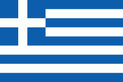
| Flag of Greece | |
Greece is considered the cradle of Western civilization, being the birthplace of democracy, Western philosophy, Western literature, historiography, political science, major scientific and mathematical principles, theatre and the Olympic Games. From the eighth century BC, the Greeks were organised into various independent city-states, known as poleis (singular polis), which spanned the Mediterranean and the Black Sea. Philip II of Macedon united most of present-day Greece in the fourth century BC, with his son Alexander the Great rapidly conquering much of the ancient world, from the eastern Mediterranean to the North Western parts of India. The subsequent Hellenistic period saw the height of Greek culture and influence in antiquity. Greece was annexed by Rome in the second century BC, becoming an integral part of the Roman Empire and its continuation, the Byzantine Empire, which was culturally and linguistically predominantly Greek.
Currency / Language
| ISO | Currency | Symbol | Significant figures |
|---|---|---|---|
| EUR | Euro | € | 2 |
| ISO | Language |
|---|---|
| EN | English language |
| FR | French language |
| EL | Greek language |


